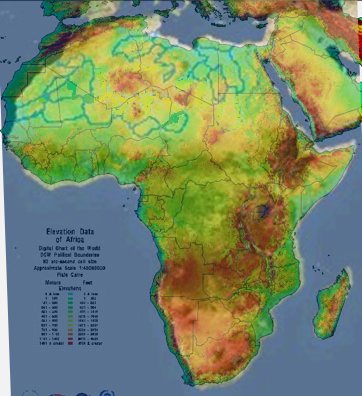
Here is a map of a canal network superimposed on an elevation map of Africa. (Blue is sea level, green is lowlands, Yellow is high lands, red is mountain ranges) The actual shape of the network would be determined by ecologists and engineers using geographic surveys.